Lucas Vance
STATEMENT OF PURPOSE — MASTER OF SCIENCE IN GEOMATICS ENGINEERING
Background:
Geospatial Systems
Specialist
Email:
lucas.vance@geomatics-
lab.org
Focus Area:
3D LiDAR Processing, GIS & Satellite
Photogrammetry
I. EXECUTIVE MOTIVATION & VISION
As modern urban ecosystems, infrastructure projects, and environmental monitoring systems grow in scale and
density, precise spatial data forms the cornerstone of resilient decision-making. Geomatics bridges the physical and
digital worlds, transforming raw Earth observation telemetry into high-fidelity, actionable spatial intelligence. Having
led multi-sensor survey teams and developed automated LiDAR processing pipelines over the past four years, I seek
to pursue a Master of Science in Geomatics Engineering to master advanced satellite geodesy, autonomous point-
cloud classification, and real-time spatial analytics.
II. ACADEMIC FOUNDATION & TECHNICAL ACHIEVEMENTS
I earned my Bachelor of Engineering in Surveying & Geoinformatics from Institute of Technology (CGPA: 3.85/4.00),
specializing in geodesy, remote sensing, and digital photogrammetry. As a Geospatial Systems Specialist at
TerraVector Analytics, I spearheaded high-precision spatial modeling initiatives for urban planning, disaster
mitigation, and infrastructure monitoring.
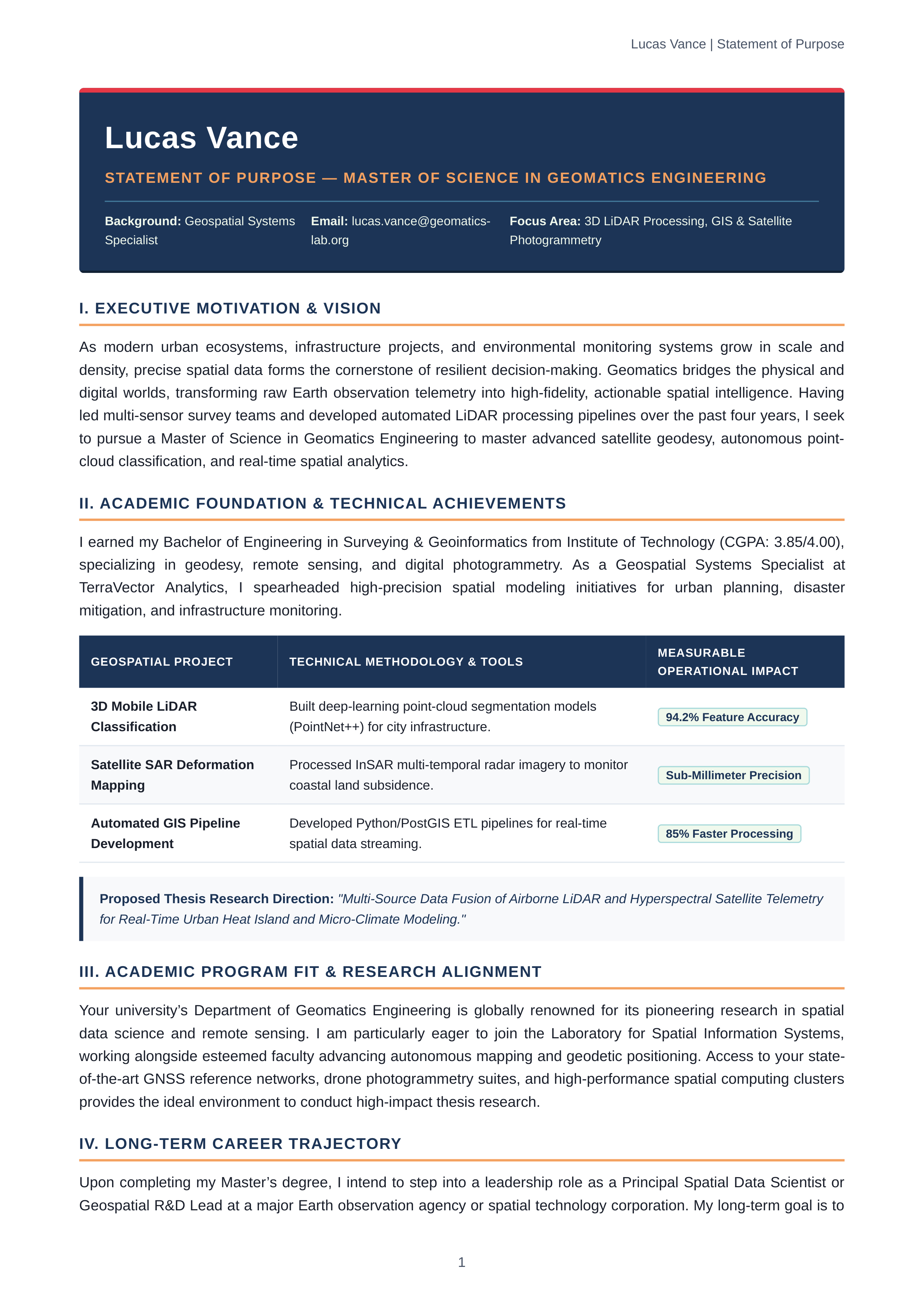
GEOSPATIAL PROJECT
TECHNICAL METHODOLOGY & TOOLS
MEASURABLE
OPERATIONAL IMPACT
3D Mobile LiDAR
Classification
Built deep-learning point-cloud segmentation models
(PointNet++) for city infrastructure.
94.2% Feature Accuracy
Satellite SAR Deformation
Mapping
Processed InSAR multi-temporal radar imagery to monitor
coastal land subsidence.
Sub-Millimeter Precision
Automated GIS Pipeline
Development
Developed Python/PostGIS ETL pipelines for real-time
spatial data streaming.
85% Faster Processing
Proposed Thesis Research Direction:
"Multi-Source Data Fusion of Airborne LiDAR and Hyperspectral Satellite Telemetry
for Real-Time Urban Heat Island and Micro-Climate Modeling."
III. ACADEMIC PROGRAM FIT & RESEARCH ALIGNMENT
Your university’s Department of Geomatics Engineering is globally renowned for its pioneering research in spatial
data science and remote sensing. I am particularly eager to join the Laboratory for Spatial Information Systems,
working alongside esteemed faculty advancing autonomous mapping and geodetic positioning. Access to your state-
of-the-art GNSS reference networks, drone photogrammetry suites, and high-performance spatial computing clusters
provides the ideal environment to conduct high-impact thesis research.
IV. LONG-TERM CAREER TRAJECTORY
Upon completing my Master’s degree, I intend to step into a leadership role as a Principal Spatial Data Scientist or
Geospatial R&D Lead at a major Earth observation agency or spatial technology corporation. My long-term goal is to
Lucas Vance | Statement of Purpose
1